The Betsiboka River flows into the Mozambique Channel in the north-west of Madagascar, in the Bombetoka Bay Delta. Its estuary is home to remarkable mangrove forests, exposed to intense hydro-sedimentary dynamics and strong human pressures.
To gain a better understanding of these dynamics, a team of scientists (UMR Espace-dev and Madagascan partners) is using time series of Sentinel 2 imagery to identify and monitor mangrove forests, as part of a satellite monitoring platform under construction, MangMap, labelled by the Space Climate Observatory. In parallel and as a complement, a project led by the same team, funded by the CNES TOSCA Committee, is developing textural processing of Pleiades imagery to characterise the structure and functioning of mangroves.
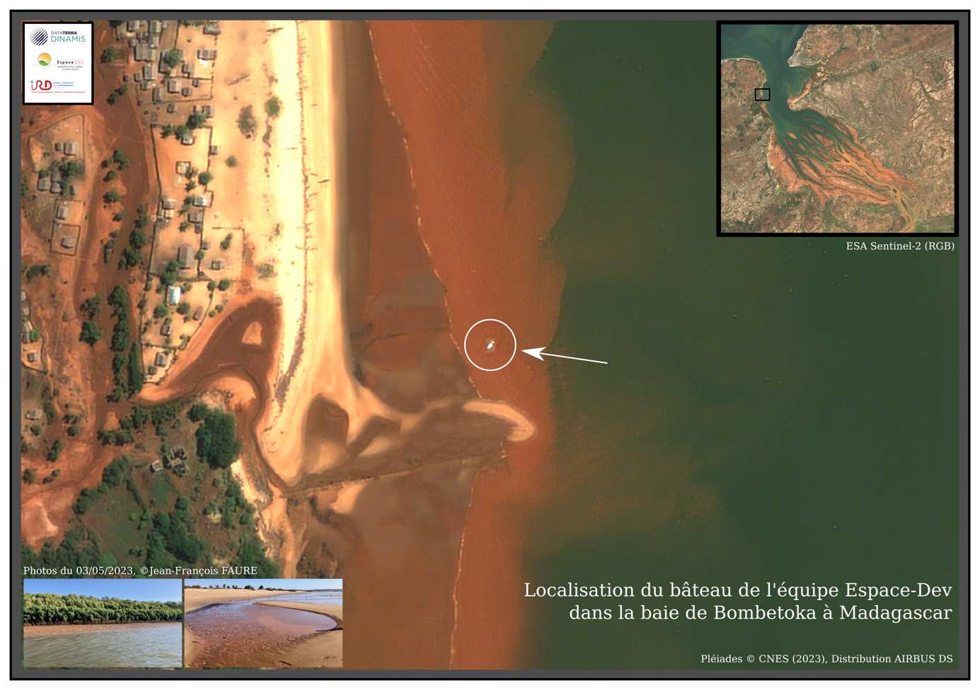
These projects called for the programming of Pleiades stereoscopic coverage of the Bay at the same time as in situ reconnaissance and data collection work was carried out in the field. The whole of the Bay was acquired by Pleiades during the field campaign, and by zooming in on the images acquired, it is possible to identify the boats aboard which the team was carrying out its sampling plan. This perfect synchronicity between in situ data collection and Pleiades satellite acquisition represents a significant contribution to the analyses envisaged by the team.